|
|
City of Rowlett Interactive Mapping User Guide
Click on the highlighted areas of the Rowlett Interactive mapping application window at right to learn more about that feature, or use the links in Help Topics.
Help Topics:
|

|
|
Zoom To Facilities: |
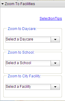 |
Select the facility from the dropdown menu.The map will zoom to that location.
You can also do search a facility by typing into the textbox.This is a dynamic list.
Example:Type in "a" will get you a list of all facilities starting with "a".
|
|
Common Map |
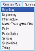 |
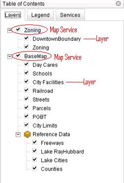
Common Map presents a list of prebuilt map themes.
One map theme represents one map service and presents
a list of map layers that allow specific themes of
geographic and environmental information to be accessed.
|
|
Satellite |
 |
When user zoom into a certain scale level, the grayed-out Satellite button will be enable and
aerial image will be available.User can easily switch the Common Map or load aerial image by clicking on the Common Map/Satellite button.
|
|
North Arrow |
 |
Click on the North Arrow to move the map view in different directions
Click the "N" to see the northern section of the map, the "S" to see the
southern section of the
map,click "NW" to see the northwest, etc.
|
|
Scale Slider |
 |
Drag the bar to choose a preset scale, while the map stays centred on the same location.
The map viewer only allows the user to view the map at specific scale levels.
These are as follow:
1:144448
1:72224
1:36112
1:18056
1:9028
1:4514
1:2257
1:1128
1:564
|
|
Overview Map |
 |
Click  button in the bottom-left-hand corner of the map to open a overview map. button in the bottom-left-hand corner of the map to open a overview map.
The Overview Map shows a birds-eye view of features(like the city streets) on a broad scale.
A red box shows the extent of the current Map Display. You can move the red box to the area you want.
|
|
|
|